Native Americans, pioneers and cowboys may have shaped the course of a young Oklahoma City but these days this oil-rich center has come into its own for other reasons, though never forgetting its old-west culture.
Follow the Rainbow Trail south for a little over a mile and then go right on the Cottonwood Trail. The trail is 3.3 miles long and generally follows Cottonwood Creek. The trail is hard for hiking.
Details
Location:
50 miles west of Pueblo
Setting:
Mountainous
Length:
6.6 mile roundtrip
Difficulty:
Difficult
Time:
3 to 4 hours
Trailhead Elevation:
9400
Elevation Change:
-2200
Season:
Summer - Fall
Useful Map(s):
USGS Quads: Horn Peak
Map + Directions
Basic Directions
Take Highway 69 south from Westcliffe (Westcliffe is 50 miles west of Pueblo) to County Road 140 (Schoolfield Lane). Turn right on CR 140 and follow it to the Comanche / Venable Trailhead.
Below are the Free Visitor Guides for Buena Vista. More Visitor Guides are available in Oklahoma. Click here to view them all!
Chaffee County Central Colorado
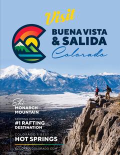
Chaffee County
Central ColoradoMore than 100 miles of the Arkansas River and her tributaries flow through the heart of Chaffee County, gracing both Salida and Buena Vista with her beauty and world-renowned whitewater, fly-fishing, scenery and river festivals. Request this Free Visitor GuideRequested!You're all set! Request a few more Visitor Guides, or complete the form below to receive your guides by mail.
We offer a compact version of Go-Oklahoma for mobile users, allowing you to access just the information you need on the road. Of course, you can still use the full version of Go-Oklahoma on your mobile device just as you can on your desktop.